 Climate
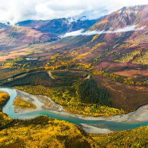
Places
Places included in Northern Climate Reports
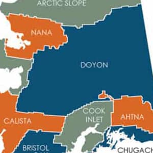
Alaska Native Corporations
Like other states, Alaska has levels of government and land
ownership: federal, state, municipal, and city. The passage of the
Alaska Native Claims Settlement Act in 1971 added an additional
layer of land ownership across Alaska.
Learn more about these regions.
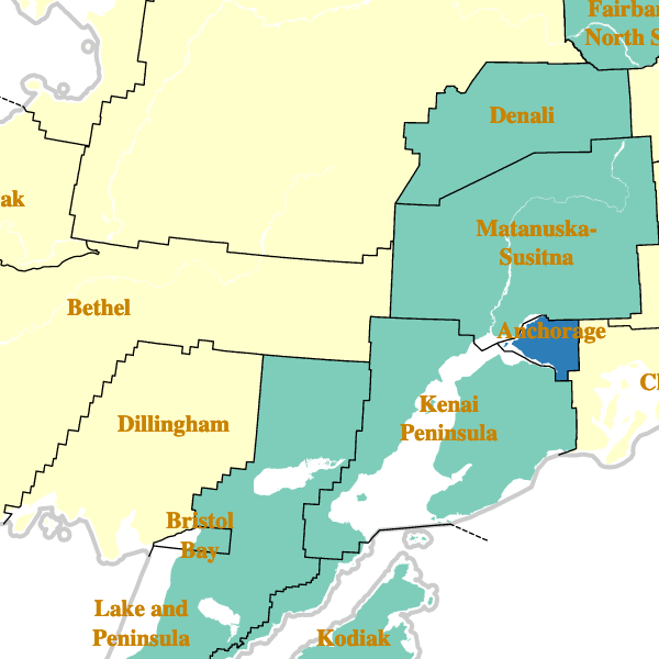
Boroughs and Census Areas
There are 19 boroughs and 10 U.S. Census Bureau-designated census
areas in Alaska. These two systems have been aggregated into 29
geographic units which correspond to 2015 census area
designations. Alaska boroughs/census areas are equivalent to
counties.
Read more about boroughs and census areas
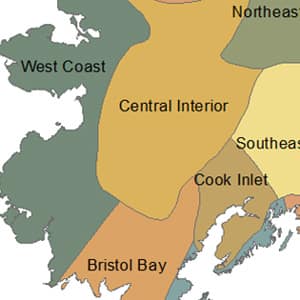
Climate Divisions
Climate divisions are subdivisions of states having roughly
consistent climatological behavior within them.
Learn more about climate divisions.
Communities
Search communities across Alaska and a portion of Canada by name. The highlighted area of the map shows the extent of the communities included in Northern Climate Reports.
We thank the Alaska Native Language Center for providing a reference of Alaska Native place names, and help with orthography.
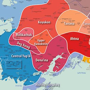
Ethnolinguistic Regions
Language boundaries represent traditional territories at approximately the year 1900 and are based on those established in Michael E. Krauss' Native Peoples and Languages of Alaska map. Learn more about Alaska Indigenous languages.
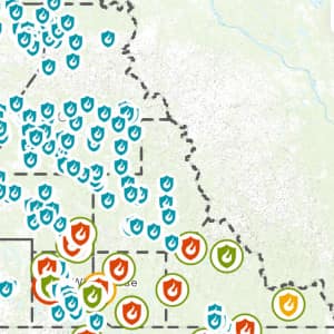
Fire Management Units
The State of Alaska Department of Natural Resources, the US Bureau of Land Management Alaska Fire Service, and the US Forest Service jointly manage the state to maximize efficient use of fire-related resources.
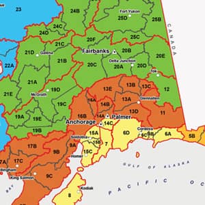
Game Management Units
The Alaska Department of Fish and Game manages hunting by dividing the state into many Game Management Units (GMUs), each with regulations on species, season, etc. Units are at the sub-unit level. Learn more about GMUs
Protected areas
Protected areas include National Parks, National Forests, Wilderness Areas, National Wildlife Refuges, State Parks and more, searchable by name and agency (NPS, USFS, etc)
Photo credit: National Park Service
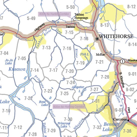
Watersheds/Hydrological Units
Hydrologic Units are included at the sub-basin (HU-8) and watershed (HU-10) level, searchable by name or Hydrologic Unit Code (HUC). Examples: “Middle Copper River” or “HUC 19020102.” Some data (flammability, vegetation change) are summarized at the sub-watershed (HU-12) level. Learn more about hydrological units
Photo credit: UAF photo by Todd Paris
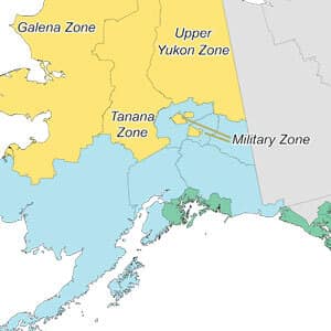
Yukon Fire Districts
Fire districts are administrative areas where wildland fire resources are allocated and deployed. They fall within one of six larger fire regions. Learn more about Yukon Fire Districts
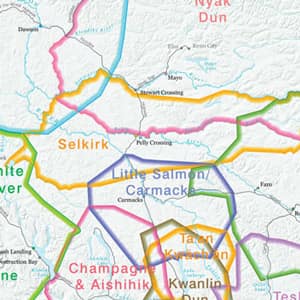
Yukon First Nation Traditional Territories
There are 14 Yukon First Nations and 8 language groups. There are also Northwest Territories and British Columbia Indigenous groups that have traditional territory in Yukon. Approximately 25 percent of Yukon’s population are Indigenous Peoples. Learn more about Yukon First Nations
Yukon Game Management Subzones
The Government of Yukon manages the harvest of wildlife within Game Management Areas, which are legal boundaries within which authorities can make regulations for managing big game. Areas are a combination of Game Management Zones and Subzones. Information is displayed at the subzone level. Learn more about Yukon Game Management Subzones
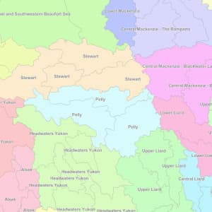
Yukon Watersheds
Yukon Watersheds are based on the Water Survey of Canada drainage area boundaries at the sub-sub-basin level, roughly equivalent to United States HU-8 level in scale. Learn more about Yukon Watersheds